Archive:
An Unsafe and Unsustainable Scheme
Highways will consider whether the proposed access (which is being applied for in detail) and movement are acceptable in delivering a safe and sustainable scheme.
On this application, planning officers may consider (amongst other matters) whether:
The access is safe and deliverable within land under the control of the applicant, landowner, or highways authority;
Access to the site is inclusive, with suitable gradients for all users;
The site is in a sustainable location, with safe and suitable access to facilities without the need to travel by car; and
Refuse storage and collection is achievable within specific distances from the highway and residents front doors.
The following points represent a high-level assessment of the planning application documents. If you want to know more about this application, a detailed assessment on all of these points can be found on the ‘Links’ tab.
It isn’t clear that the access can be provided as drawn.
The Transport Statement shows visibility splays extending beyond the application red line boundary. It is unclear whether the applicant or landowner have legal rights over this land to construct and maintain the required visibility splays. Without this clarity, it cannot be demonstrated that a safe and suitable access can be lawfully delivered.
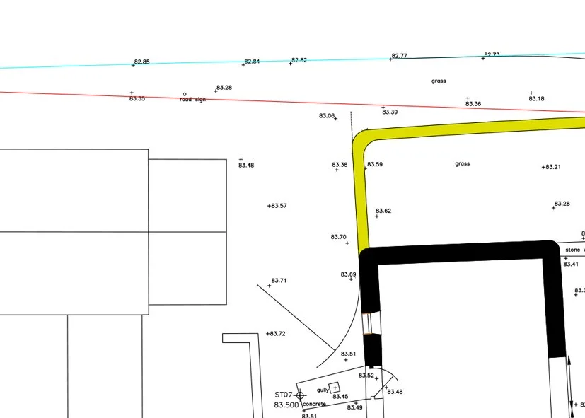
The proposed access is too steep, and to make it compliant would undermine Mattingley Barn.
No topographical survey has been provided despite significant level changes. Analysis of the site topography provided on a recent planning application for the neighbouring Mattingley Barn shows the access gradient would be approximately 1 in 10.7 – far exceeding the Department for Transport Inclusive Mobility guidance maximum of 1 in 20. Achieving compliant gradients would require excavation that could undermine the foundations of the adjacent Mattingley Barn.
The roads aren’t wide enough for cars to pass.
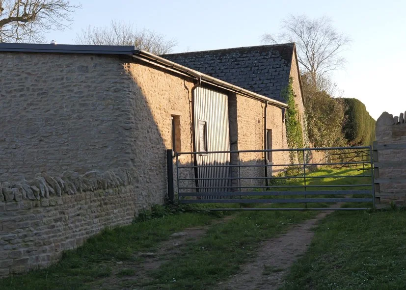
The access width is inadequate. The physical gap between buildings is 4.7m, yet the Transport Statement claims the access will be widened to 5.0m – which is physically impossible. The internal roads at 3.8m width fall below the Oxfordshire Street Design Guide standard of 4.8m for two-way traffic, yet no passing places are shown or mentioned.
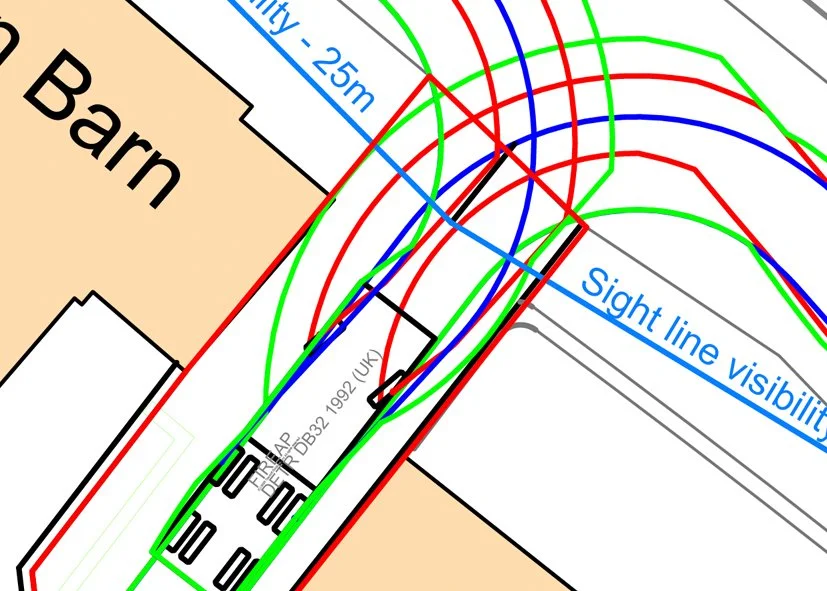
The swept path drawings show even emergency vehicles cannot get into the site without hitting the side of 3 The Green Barn or the boundary wall of Mattingley Barn.
Vehicle tracking drawings within the Transport Statement only show swept path analysis drawings for a fire appliance. On these plans the green lines represent the outside of the vehicle which clash with the outside wall of 3 The Green Barn, and the stone boundary wall of Mattingley Barn.
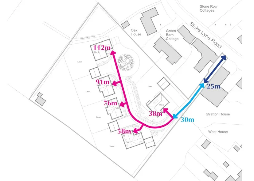
Bins would need to be dragged almost 4 times the maximum allowed, and even then they would be left outside the bedroom window of Mattingley Barn.
The refuse strategy is fundamentally non-compliant. Cherwell DC will not collect waste from private roads. Regulations require refuse to be within 25m of the adopted highway and no more than 30m from residents' storage. None of the five proposed dwellings comply with these distances – plot 4 is 112m from the highway, almost four times the maximum. Furthermore, 10-15 wheelie bins at the collection point would obstruct the narrow 3.8m access and sit directly outside bedroom windows of Mattingley Barn.
The data used to calculate car use assumes Stratton Audley is a town, not a rural village.
The TRICS data used to assess vehicle movements is inappropriate and misleading. All 35 survey sites are classified as ‘edge of town centre’ or ‘edge of town’ – not a single rural village site. Stratton Audley as a Category C village with high car dependency will generate materially higher trip rates than the suburban averages used.